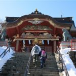
Nikko (日光), located in 100 km north of Tokyo, is a popular tourist destination. Temples and shrines are registered as a World Heritage Site, so many tourists visit from all over the world.
In the west of Nikko, there is a mountainous area : Oku-Nikko (奥日光). In Oku-Nikko, there are 2000 m class mountains including Mt. Nantai, and many beautiful places. It is the best area for those who like outdoor activities and natural observation.
Area Map
Mt. Nantai
About
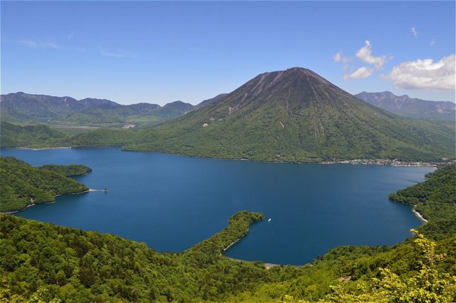
Mt. Nantai (Nantai-san) is a conical volcano height of 2486 m located in central Oku-Nikko. It is a symbol of Oku-Nikko and one of the “100 Famous Japanese Mountains”.
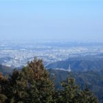
On a clear day, you can find it from Tokyo. Although it is classified as an active volcano, recently there is no volcanic activity.
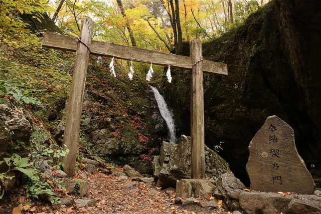
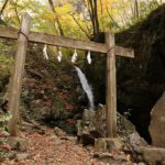
Mt. Nantai has long been the subject of faith, and there are shrines and many items related to religion near the mountain.
Climbing Guide
The major climbing course is Omote-sando trail. The difference in altitude of the trail is 1200 m. It takes about 4 hours to go up the mountain and 2.5 hours to go down.
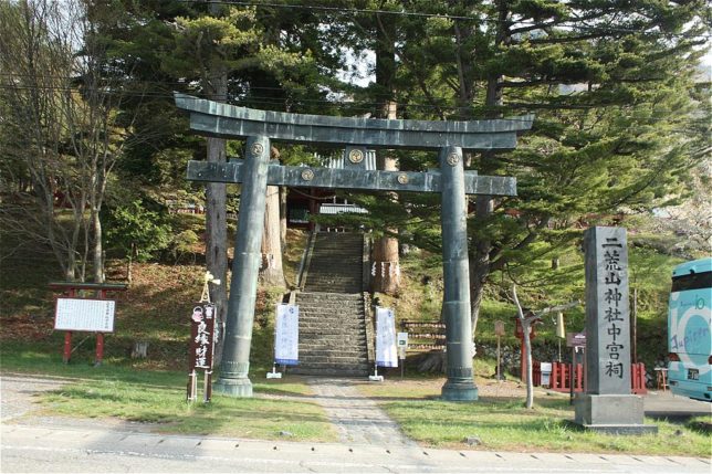
The trail starts from Futarasan Chugushi Shrine (二荒山神社中宮祠). You must pay 500 Yen for a climbing fee at the shrine.
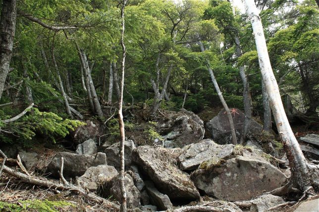
The trail has a steep slope and many rocks, so be careful. At around 1600 m altitude, the trail partially joins the paved road (road for civil engineering work). Check your map carefully so as not to go the wrong way.
The mountain skin is covered with bamboo grasses, coniferous trees and rhododendrons. From late May to July you can see rhododendron flowers.
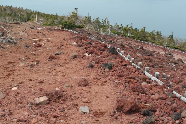
As you approach the summit, you will find that the ground gradually turns red-brown. This is because of lava rocks
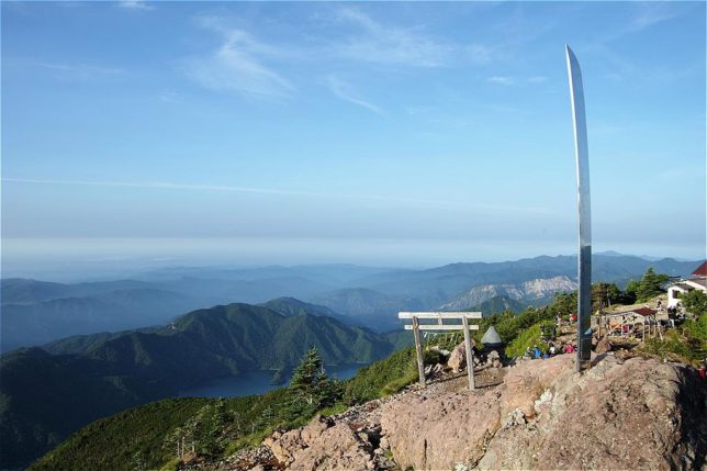
The summit is very scenic. You can see Lake Chuzenji and many mountains.
Mt. Nantai is a mountain of religion, so there are some religious objects such as torii (monument of shinto), sword and statue of god on the summit.
Season
Mt. Nantai climbing is allowed from early May to late October.
| May | Fresh green, Little cold |
| June – Early July | Rainy season (But not all rainy) |
| Mid July – Mid Sept. | Warm, Afternoon thunderstorm |
| Late Sept. – Oct. | Autumn leaves, Cold |
Best season is from May to July. Although it is the rainy season from June to July, there are fine days, too.
Oku-Nikko
Kegon Falls (華厳ノ滝)

Kegon falls (Kegon-no-taki) is a 100 m tall waterfall located at the entrance of Oku-nikko area. It is said to be the one of “3 famous waterfall in Japan”.
Access : 10 minutes walk from Chuzenji-onsen (中禅寺温泉) bus stop.
Lake Chuzenji (中禅寺湖)
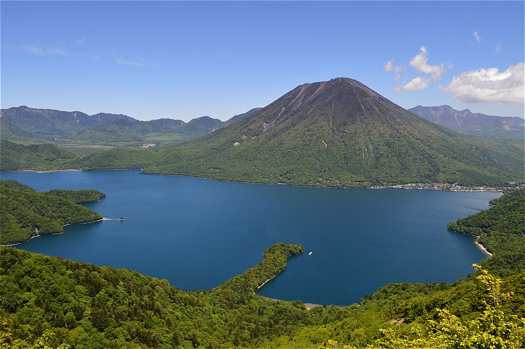
Lake Chuzenji or Chuzenji-ko is a scenic lake located at the foot of Mt. Nantai.
You can enjoy lakeside walking, pleasure boat cruising. There are two boat piers, one is near the Chuzenji-onsen(中禅寺温泉), and the other is near Shobugahama(菖蒲ヶ浜).
There are many accommodation facilities on the lake shore. In the Chuzenji-onsen area, there are some Japanese style onsen hotels. If you are outdoor lovers, camping at Shobugahama campsite will be the best choice.
Senjogahara Wetland(戦場ヶ原)
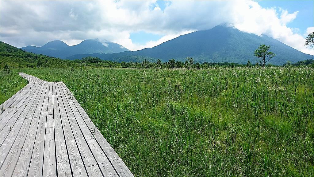
Senjogahara is a vast wetland of 400 ha located in the north of Lake Chuzenji. It’s listed in Ramsar wetland because wide variety of animals and plants are inhabited.
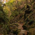
Walking paths are installed in wetlands and you can observe nature by walking. It takes about 2 hours to walk around the entire wetland.
The main entrance of the Senjogahara is Akanuma bus stop (赤沼). There are toilet, restaurant, and information center.
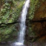
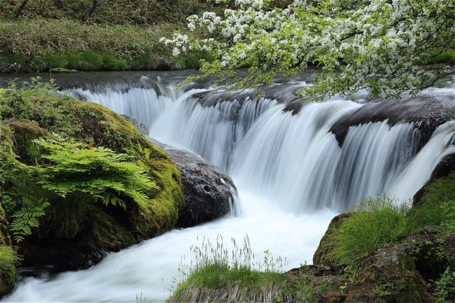
Ryuzu Falls (竜頭ノ滝)
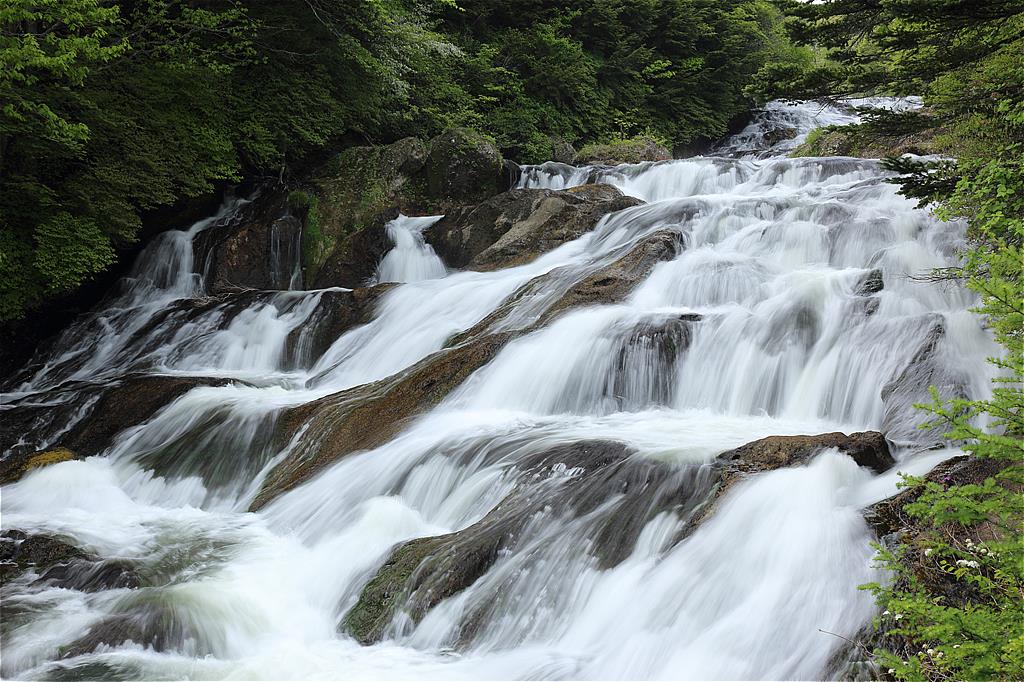
Ryuzu Falls or Ryuzu-no-taki is a beautiful waterfall located between Lake Chuzenji and Senjogahara. It consists of two waterfalls. The autumn waterfall is a particularly beautiful and many tourists visit.
You can go there by bus (Ryuzu-no-taki bus stop) and also you can walk from Senjogahara (see area map). There are some small waterfalls between Ryuzu falls and Senjogahara.
Example Plan
<Day 1>
Move from Tokyo to Nikko
Sightseeing world heritage sites (Toshogu and so on)
Stay at a hotel near Lake Chuzenji
<Day 2>
Climbing Mt. Nantai
Chuzenji-onsen(hot spring) and Kegon Falls
Stay at Shobugahama Camp Site
<Day 3>
Hiking at Ryuzu Falls and Senjogahara
Go back to Tokyo
Access
Tokyo -> Nikko area
If you are in Tokyo, go to Asakusa(浅草). There are many express trains between Asakusa and Nikko. Be aware that there are several Asakusa Stations. What you should go is Asakusa Station of Tobu railway.
At Asakusa Station, get on Kegon Express
(特急けごん) or Kinu Express (特急きぬ). If you use Kegon, get off at Tobu-nikko Station (東武日光) , the last stop of the train. If you use Kinu, get off at Shimo-imaichi Station (下今市) and change to the local train for Tobu-nikko. There are also Revaty Kegon Express and Revaty Kinu Express. These are same as Kegon Express and Kinu Express.
It takes about 2 hours from Asakusa to Tobu-nikko Sta.
Nikko area -> Oku-Nikko area
At Tobu Nikko Station bus terminal, get on Tobu bus for Yumoto-onsen(湯元温泉) . If you are going to go to Kegon Falls, Mt. Nantai or Lake Chuzenji, you can also take buses for Chuzenji-onsen(中禅寺温泉)
It takes 50 mins from Nikko Station to Chuzenji-onsen, and 40 mins from Chuzenji-onsen to Yumoto-onsen.
There are some reduced bus tickets. For more information about the buses, please check here.